Could growing islands and
carbon super trees help save
the Great Barrier Reef?
It was thought mangrove forests were particularly vulnerable to disruption by sea-level rise. But new research shows mangrove forests on some remote islands of the northern Great Barrier Reef have rapidly expanded over recent decades during a time of sea-level rise.
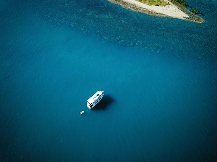
As our small inflatable boat pulls up to the pristine white sands of the uninhabited Pipon Island, Dr Jeff Kelleway is first to jump out. Dressed with a floppy hat, long-sleeve shirt, a compass hanging from his neck, long pants and gum boots, his is not the attire of a weekend getaway on a deserted island in the middle of the Great Barrier Reef. Likewise, this forlorn landscape is no tropical paradise.
Following Dr Kelleway, who is a research fellow in the School of Earth, Atmospheric and Life Sciences at the University of Wollongong (UOW), is Associate Professor Sarah Hamylton, along with PhD students Zachary Nagel-Tynan and Oxana Repina.
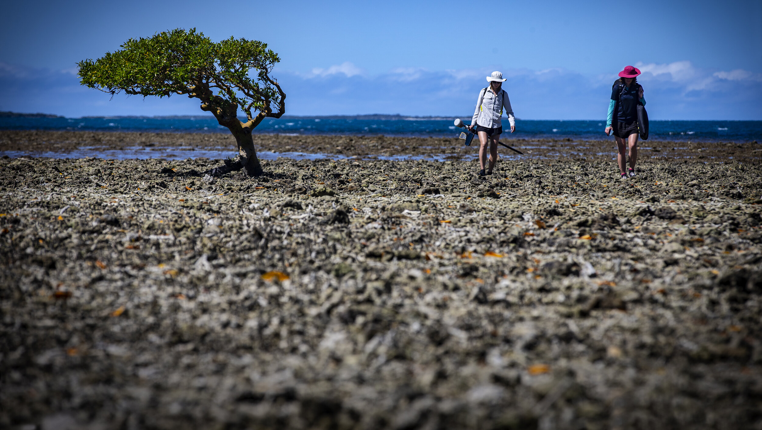
The team of scientists are mapping and investigating the Howick group of islands, approximately 130 kilometers north-east of Cooktown, in far northern Queensland. The island of Pipon is one of Howick’s 19 continental islands and sand cays that pepper this far flung part of the Great Barrier Reef.
The crew of researchers, now safely ashore with an array of plastic suit cases, tape measures and various digging tools, refer to a collection of digital images to plan their activities on the small island.
“Isn’t this totally amazing?”, says Associate Professor Hamylton, a marine geographer from the University of Wollongong and leader of the project funded by the Australian Academy of Science. “There a real sense of remoteness out on these unspoiled islands, along with fantastic scenic appeal.”

“Sure, the media headlines have portrayed the reef as dying or dead, but that’s an oversimplification, it’s a bit more complicated than that. Let’s not ride the reef off just yet.”
— Oxana Repina PhD Student University of Wollongong
Mapping Islands.
The UOW fieldtrip involves collecting thousands of aerial drone images, ground referencing photographs and mangrove forest surveys of 10 different islands among the Howick Group. This data will be used to monitor mangrove expansion and other changes to reef flat environments from island to island.
Associate Professor Hamylton explains the group will compare their new aerial images taken from an unmanned aerial vehicle (UAV or ‘drone’) to hand-drawn maps created in 1928 and photos from 1974. “This research was started back in 1928 with an expedition known as the Great Barrier Reef Low Isles Expedition.”
Back in July 1928, a group of British and Australian scientists embarked on an epic expedition to investigate the greatest coral reef in the world. The researchers would eventually spend 13 months wandering to and from reefs and islands. The team investigated everything from ocean conditions, growth rate of corals, and the biological and geological complexities of a reef that is more than 2300 kilometers long.
But it was one of the 1928 expedition’s point of interest that has attracted the UOW research team to the Howick Islands. “Two members of the Great Barrier Reef Low Isles Expedition were particularly interested in how old the reef islands around here are and how were they formed” Says Associate Professor Hamylton.
“The researchers observed ocean waves and tidal currents transporting loose coral sediments derived from the underlying reef platform and depositing these to form the islands. Sometimes these cays or islands may remain unconsolidated and move around with the seasons. But over time the larger cays built up to be above the sea level and become covered in vegetation, which stabilizes them into more permanent features.”
Forty-five years later, in 1973-74, another group of researchers, the Royal Society and Universities of Queensland Expedition, decided to retrace the footsteps of some of the researchers from the 1928 expedition. They concentrated on remapping the Howick Islands, as well as other islands further north, in more detail. By remapping the islands and collecting more data on the majority of islands with mangrove forest vegetation, the researchers believed the updated data could inspire subsequent studies and could continue to generate alternative hypotheses about changes to reef landscapes that future environmental scientists may be able to test.

“Mangrove trees capture carbon dioxide from the atmosphere, and then trap and store it in their carbon rich soils for hundreds or thousands of years.”
— Dr Jeff Kelleway
And the 1974 research did inspire more investigative work. The information caught the eye of Associate Professor Hamylton who has a keen interest in geomorphology, which examines how landscapes like the islands on the Great Barrier Reef form and are shaped over time.
“When I looked over the maps from 1928, then some aerial photos from 1974, I then compared these maps and images with recent satellite imagery from the internet and could plainly see that the islands had increased in size. Especially since 1974.”
So, with funding from the Australian Academy of Science the team from UOW set off to test the theory that a certain number of islands in the Howick Island where indeed getting bigger and were the mangrove forests thriving in these new climatic conditions?
Extraordinary Mangroves.
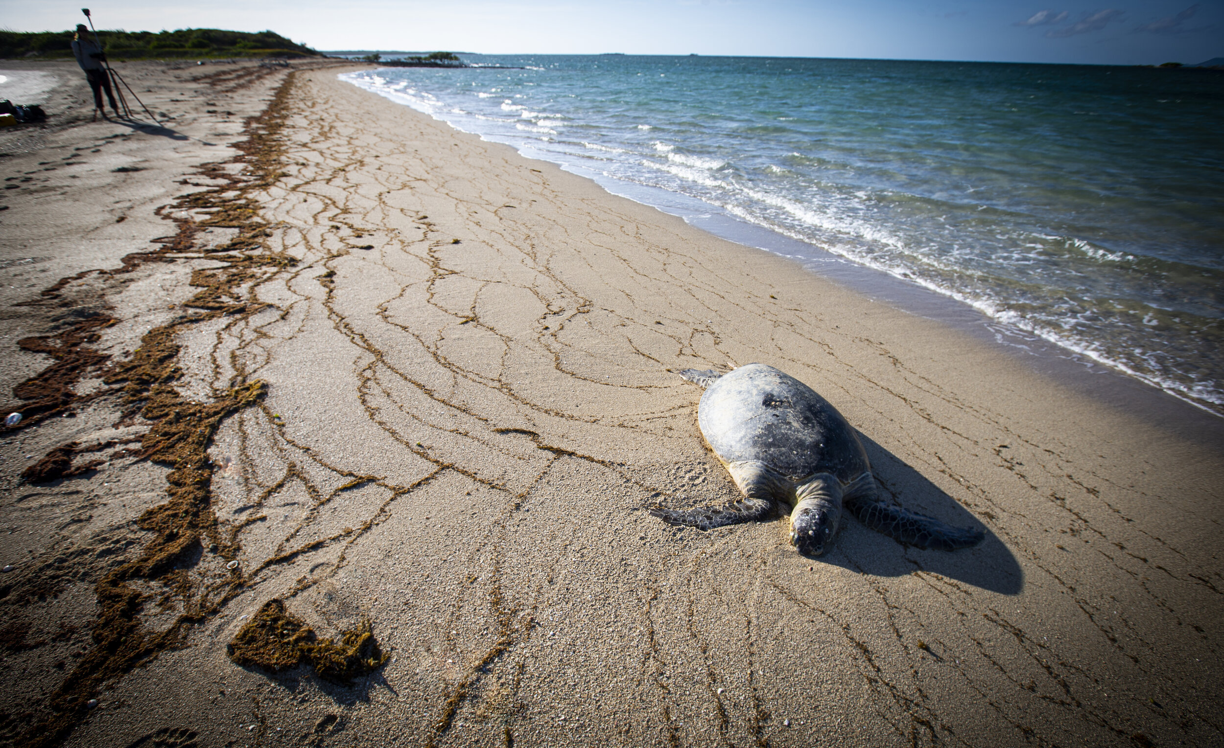
While scientists have long known these trees and their ecosystem play a huge role in nurturing fish populations and buffer the island shores from storms and ocean surges, it’s only recently that scientists have realised how important these forests are when it comes to climate change.
According to Dr Kelleway, mangroves are truly magical forests. “Mangrove forests on these islands are so important. The dense underground root system helps bind soils and build elevation, while the above-ground roots provide shelter for marine life and slows down water flows and encourages sediment deposits that reduce erosion.”
But what gets Dr Kelleway really excited when talking about mangroves is the term ‘Blue Carbon’. As it turns out, mangroves are great at removing and storing the carbon that humans have put in the atmosphere.
Deep inside Pipon Island’s mangrove forest, climbing over a tangle of roots, Dr Kelleway waves his hand toward an abundance of Rhizophora mangrove trees, also known as a stilt mangrove.
The Rhizophora with its outlandishly tall roots and dense mud beneath them, are important tools in a climate emergency. In this forest, we will measure heights, and trunk sizes of mangrove trees and figure out how much carbon this ecosystem can hold.
“Mangrove trees capture carbon dioxide from the atmosphere, and then trap and store it in their carbon rich soils for hundreds or thousands of years,” Dr Kelleway says. “The term Blue Carbon came about because the buried carbon is stored underwater in coastal ecosystems.”
He says it’s only now — in the age of climate change — that scientists are beginning to understand that mangrove forests are truly extraordinary in their ability to store carbon. And he says, the mangrove forest is virtually unmatched by any other ecosystem on Earth.

Benefits of protecting one hectare of mangrove forest. Images and Source: Conservation International

Ever Expanding Havens.
As the Pipon Island day ends, the UOW team gather around a small table aboard the reef survey vessel, the Kalinda.
Associate Professor Hamylton examines a series of images taken that day by the unmanned aerial vehicle (UAV). Using the latest 3D photo stitching computer software, she compares the latest images of Pipon Island with the hand drawn maps from the 1928 expedition and the photographs from the 1974 expedition.
“What’s particularly interesting for a lot of the islands in the Howick group that we are mapping and investigating is that, they are growing.”
And indeed, they are. The simple explanation for growth on these islands is an increase in coral sediment building up the island and mangrove forests expanding over this new sediment.
“Most of the islands we have looked at are predominantly made up of broken up corals, which waves then sweep and deposit on the island. This coral sediment is responsible for building up the islands. Add in mangrove forests and you can see that these islands are actually growing! Some mangrove forests are marching forwards by some five to six meters per year,” Associate Professor Hamylton explains.
So, why are other islands further north in the Torres Strait, where rising sea levels, coastal erosion, unpredictable winds and destructive king tides are increasingly washing away roads, buildings and even cemeteries?
That is a question that the research team want to answer.
“At this early stage of data analysis, it’s still too early to have a clear indication as to why. It could be the deforestation of mangrove forests or it could have to do with the health of reef around the islands.” Says Dr Kelleway.
According to the UOW research team, maps have transformed the way we have responded to both historic and contemporary coral reef problems.
“The 1928, the expedition team hand drew all their maps of the northern Howick Islands and it’s essential to understanding how past maps were made. That determines the appropriate uses to which they can be put.” Says Associate Professor Hamylton.


She explains the hand drawn maps where produced using a plane table as a drawing board. The paper would be then be clamped by heavy screws fitted with large wings. Then along with sighting instruments, a wooden ruler, an ivory scale rule and a trough compass the 1928 team would record distances and transfer their measurements onto the paper. The whole kit would then be bundled up into two large stiff canvas bags and transported to the next location.
“Our new mapping with our UAV (drone) of the Howick Islands not only shows how modern technologies are employed to produce them, but that mapping has been and continues to remain a fundamental activity that underpins the understanding of coral reef environments and helps to shape policies in resource management and conservation.”
On the 27-hour boat trip back to Cairns, the research team sit around the small dinner table and discuss their adventures and discoveries. There is laughter and sadness, stories about the reef itself, the constant fear of hidden crocodiles and the drone that had blown off course and almost lost due to strong winds.
When asked of the group, is mapping and mangrove research of small islands on the reef worthwhile, the young PhD student in Philosophy, Oxana Repina has the last word. “The fate of the Great Barrier Reef depends on how quickly we address humanmade pressures like climate change and try to reduce greenhouse gas emissions. This place is among the most diverse and iconic ecosystems on Earth. Sure, the media headlines have portrayed the reef as dying or dead, but that’s an oversimplification, it’s a bit more complicated than that. Let’s not ride the reef off just yet.”
All Black and White photos courtesy Queensland Library. C.M. Yonge 1928. Colour photos Paul Jones 2021.
Watch the video or listen to the audio story.
Video Story

Audio Story